Building and Terrain Height
Because China Lacks 3D models for buildings and the information regarding height isn't accurate on google earth BTE Mainland China must find innovative ways to best calculate how tall buildings are and how far above sea level the ground is.
Terrain Height
• At the moment our target cities are Beijing, Shanghai and Shenzhen. This means terrain height isn't particularly complicated given these cities are located fairly close to sea level and are reasonably flat in nature. • Therefore we have elected to use topographic height maps to roughly track terrain heights. In Plan 计划 you will be able to find one for the relevant city you are interested in building.
Building Height
In general there are 2 methods of getting building height firstly through search and secondly through floor-based estimation.
1. Searching For Building Height.
• Most major buildings have their height and dimensions available on the internet. • If you can find the building name you can search for it on https://www.ctbuh.org/.
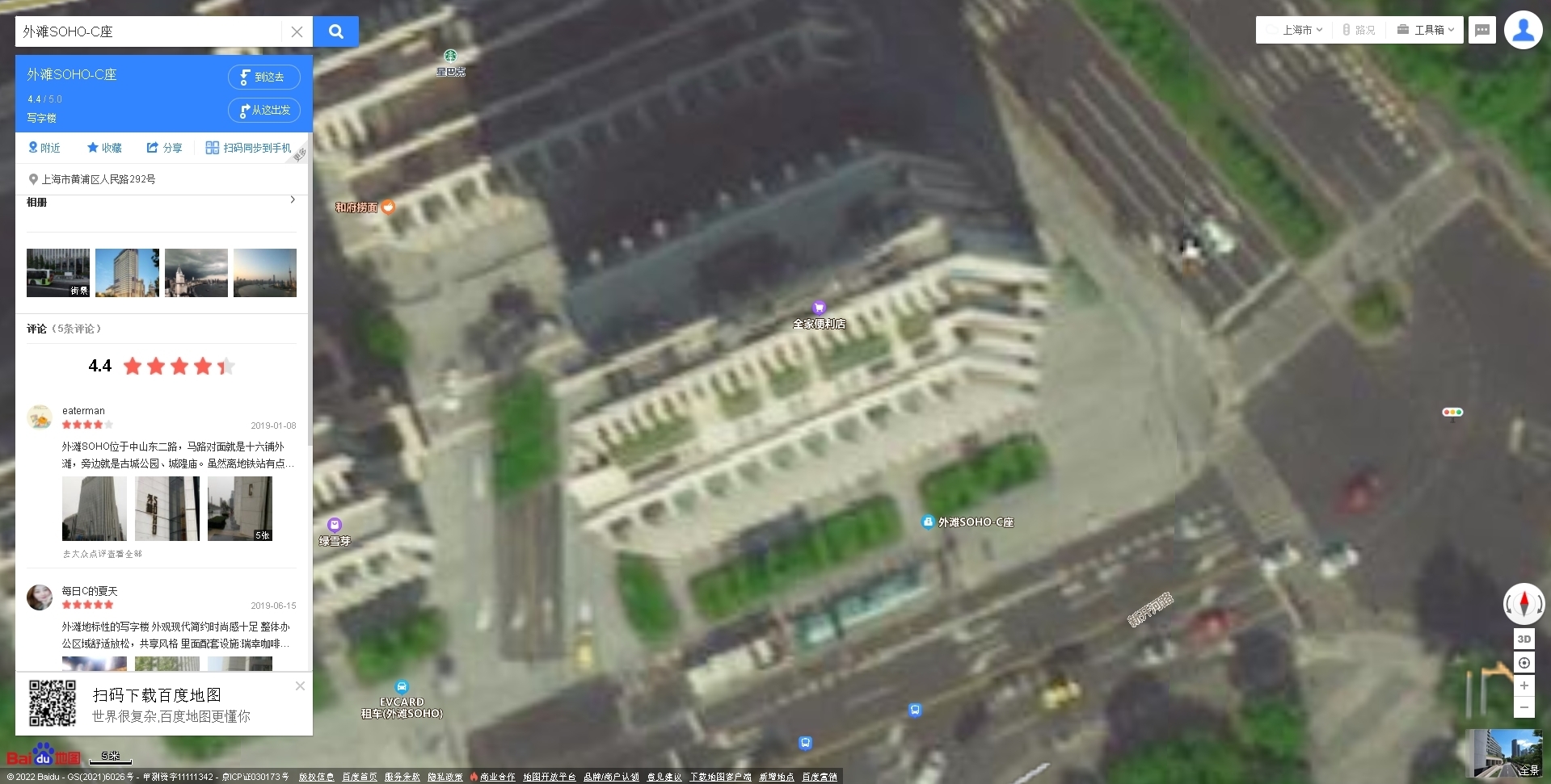
• Here for Example if we wanted to find this building from Baidu maps we can see it's called: (translates to Bund Soho-C Block).
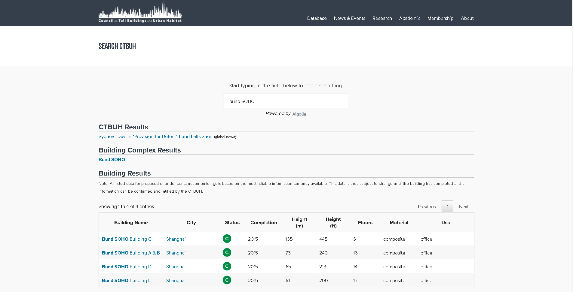
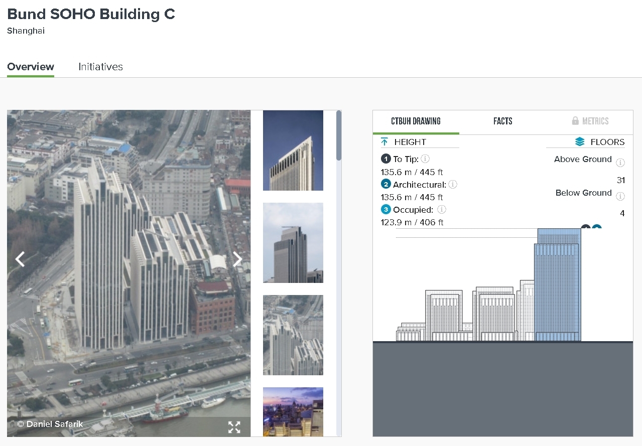
• Searching Bund Soho on ctbuh we find the Building and it's associated measurements.
2. Approximate Based on the number of floors.
• If there is no available data that you can find regarding the height of a building and you have tried step 1 we try to estimate the height of a building based on the number of floors. • As a standard we will estimate the distance between the bottom of one floor to the next as being 3m (3 Blocks). So if we count 10 floors assume the building is 30m tall. • Clearly this is not an exact science and builders will have some level of creative license. • Use Baidu street view as your visual for counting floors. To learn how to use street view, check out Navigating Maps 导航地图. • Note: What is displayed in f3 is actually the block your legs are NOT the block you are standing on. Therefore everything should be measured as f3 Y+1.
Last updated